File:Polleidet powerlines map.jpg
Size of this preview: 453 × 600 pixels. Other resolution: 524 × 694 pixels.
Original file (524 × 694 pixels, file size: 87 KB, MIME type: image/jpeg)
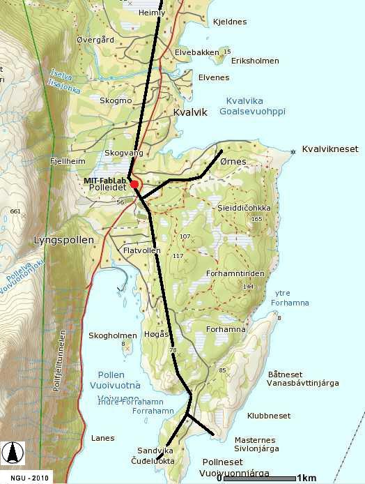
Mapping of the local distribution power lines in the Polleidet area.
File history
Click on a date/time to view the file as it appeared at that time.
| Date/Time | Thumbnail | Dimensions | User | Comment | |
|---|---|---|---|---|---|
| current | 09:06, 14 September 2010 | | 524 × 694 (87 KB) | Beau (talk | contribs) | Mapping of the local distribution power lines in the Polleidet area. |
You cannot overwrite this file.
File usage
The following page uses this file: