File:Roads to Lyngen map.jpg

Size of this preview: 619 × 599 pixels. Other resolution: 689 × 667 pixels.
Original file (689 × 667 pixels, file size: 158 KB, MIME type: image/jpeg)
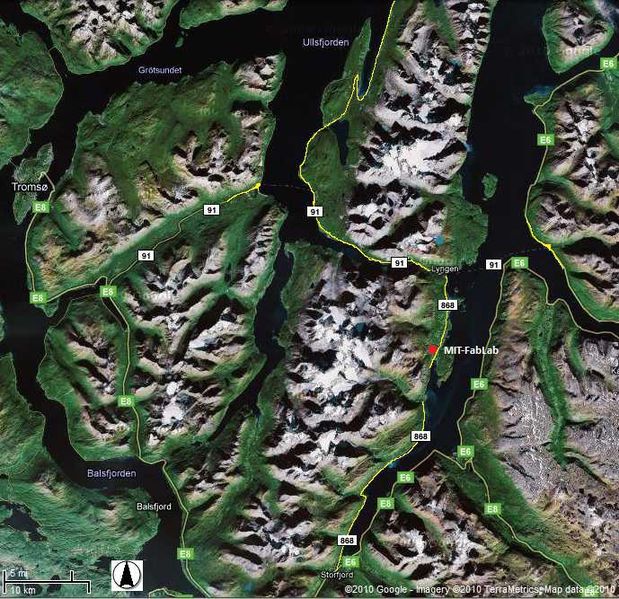
Mapping of major roads to and from the Lyngen peninsula.
File history
Click on a date/time to view the file as it appeared at that time.
| Date/Time | Thumbnail | Dimensions | User | Comment | |
|---|---|---|---|---|---|
| current | 14:41, 14 September 2010 | | 689 × 667 (158 KB) | Beau (talk | contribs) | Mapping of major roads to and from the Lyngen peninsula. |
You cannot overwrite this file.
File usage
The following page uses this file: