Uploads by Beau
Jump to navigation
Jump to search
This special page shows all uploaded files.
| Date | Name | Thumbnail | Size | Description | Versions |
|---|---|---|---|---|---|
| 14:36, 21 September 2010 | Polleidet.JPG (file) |  |
1.7 MB | The Polleidet area taken from the cliffs that run through the middle of the Lyngen peninsula. | 1 |
| 14:32, 21 September 2010 | Drying fish.jpg (file) |  |
324 KB | Hang drying fish in the Lyngen area of nothern Norway. | 1 |
| 14:25, 21 September 2010 | Lyngstuva.JPG (file) |  |
1.7 MB | Lyngstuva the northern most tip of the Lyngen peninsula. | 1 |
| 14:18, 21 September 2010 | Lyngen range from east.JPG (file) |  |
1.86 MB | The Lyngen peninsula from the east side of the Lyngen fjord. (March) | 1 |
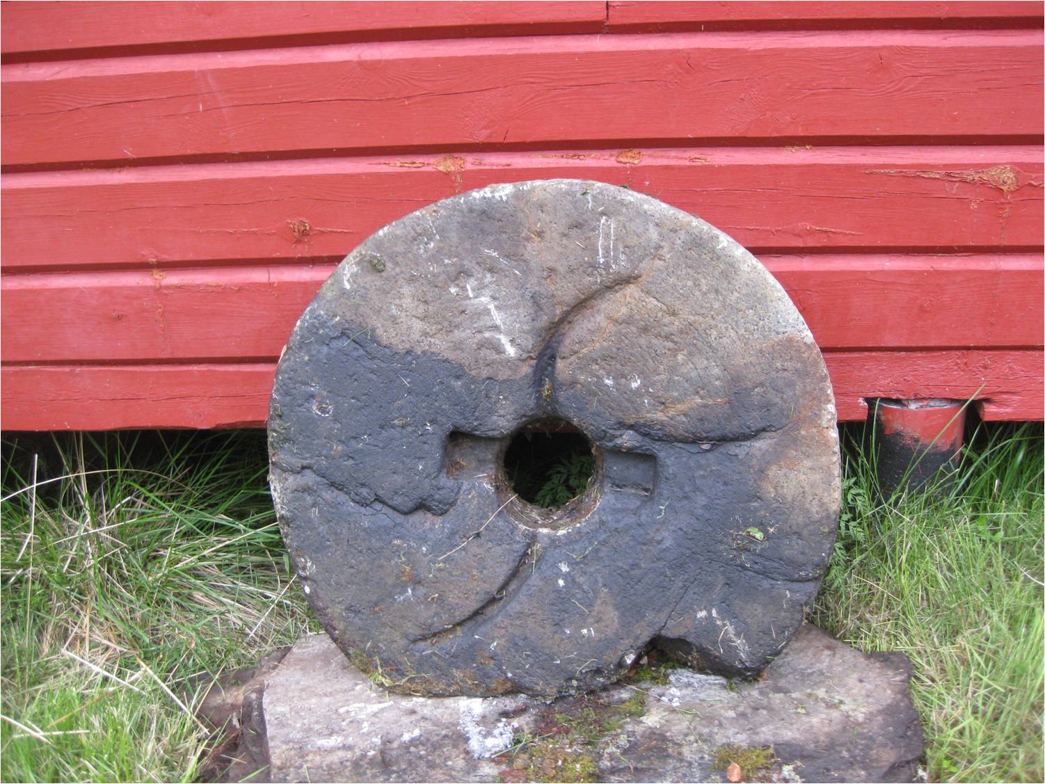
| 09:13, 21 September 2010 | Millstone.JPG (file) |  |
271 KB | Millstone from northern Scandinavia (Gällivare,SE). | 1 |
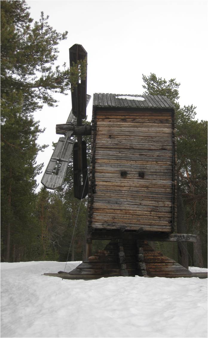
| 09:08, 21 September 2010 | Northern windmill.jpg (file) |  |
99 KB | Historic windmill from northern Scandinavia (Gällivare, SE). | 1 |
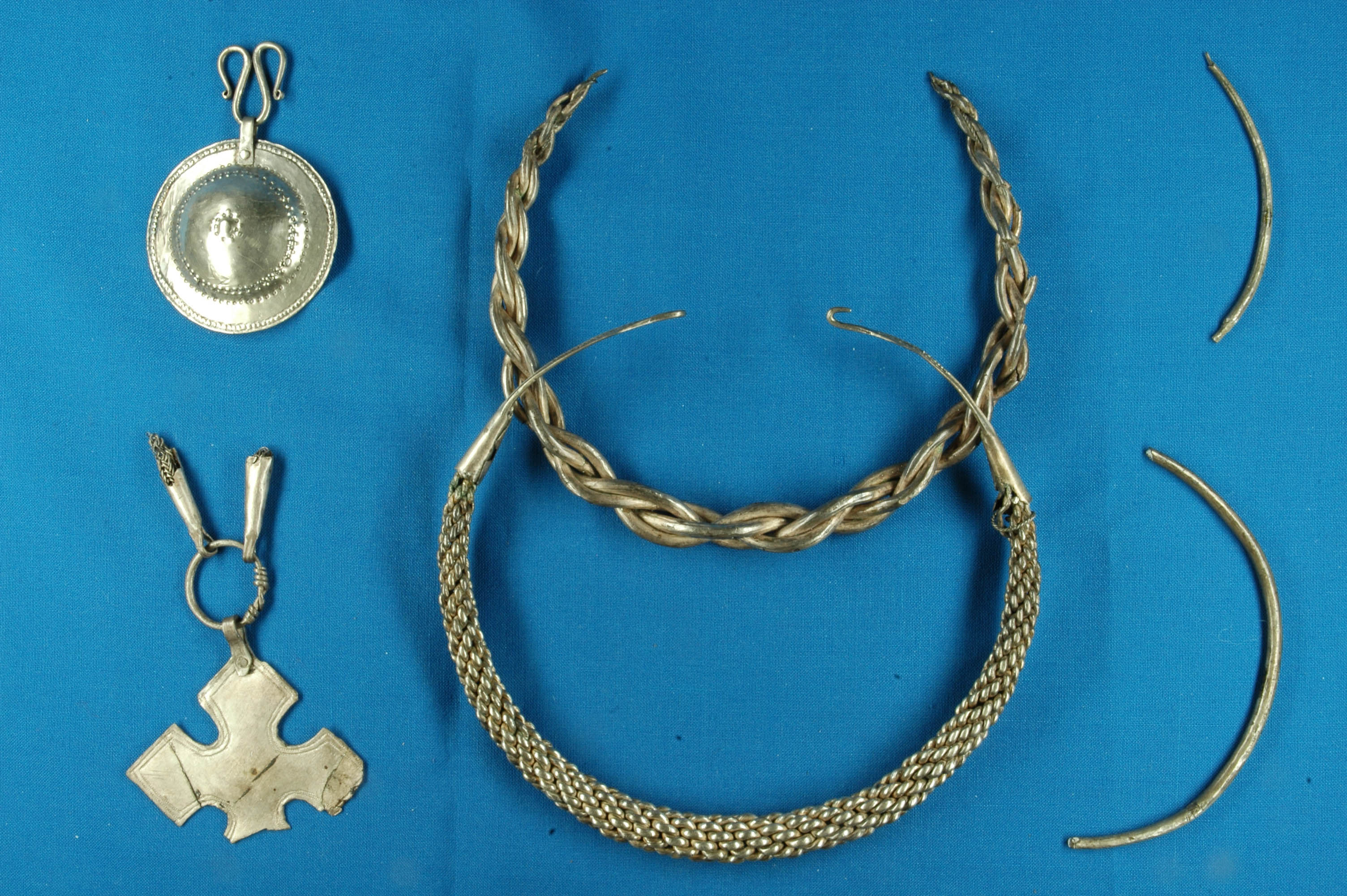
| 06:55, 16 September 2010 | Flatvollsmykkene.jpg (file) |  |
968 KB | Jewelry uncovered in the Pollen area of Lyngen peninsula dating back to the bronze age. | 1 |
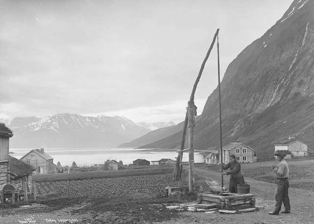
| 14:19, 15 September 2010 | Pollen 1880-1890, Axel Lindahl.jpg (file) |  |
28 KB | Pollen settlement 1880-1890, Lyngen, Norway. Photograph taken by Swedish photographer Axel Lindahl. | 1 |
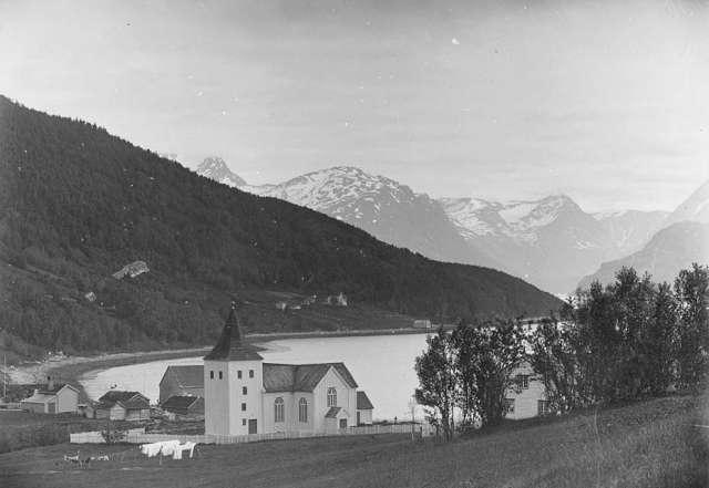
| 14:15, 15 September 2010 | Lyngen kyrkje Lindahl.jpeg (file) |  |
34 KB | Lyngen church in Lyngseidet, 1880-1890. Photo taken by Swedish photographer Axel Lindahl | 1 |
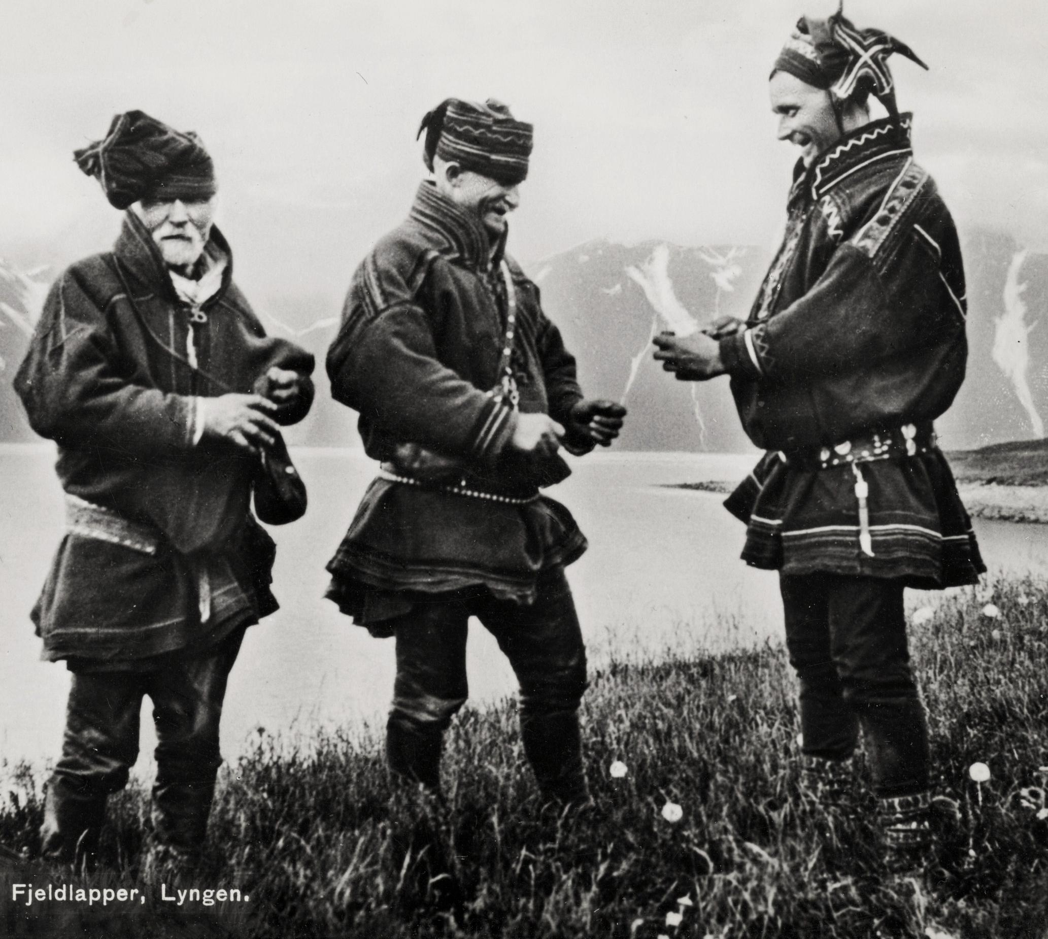
| 14:06, 15 September 2010 | Sami men exchanging Tobacco Lyngen, Troms, Norway.jpg (file) |  |
412 KB | Three Sami men are exchanging Tobacco in Lyngen, Troms, Norway. Tre samiske menn bytter tobakk i Lyngen, Troms, Norge. Read more in Saamiblog: http://saamiblog.blogspot.com/ | 1 |
| 07:46, 15 September 2010 | Nordlysnewpaper.jpg (file) |  |
185 KB | Nordlys the largest circulating newspaper in norther Norway | 1 |
| 14:41, 14 September 2010 | Roads to Lyngen map.jpg (file) |  |
158 KB | Mapping of major roads to and from the Lyngen peninsula. | 1 |
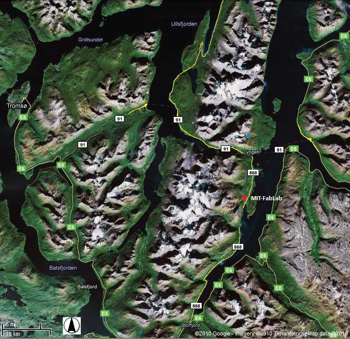
| 09:12, 14 September 2010 | Powerstation rottenvik.jpg (file) |  |
176 KB | Mapping of Lyngen's hydroelectric power station and power lines at Rottenvik. | 1 |
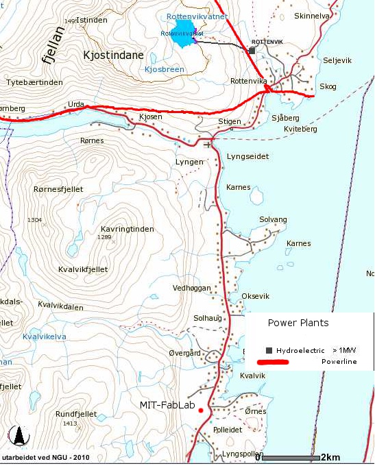
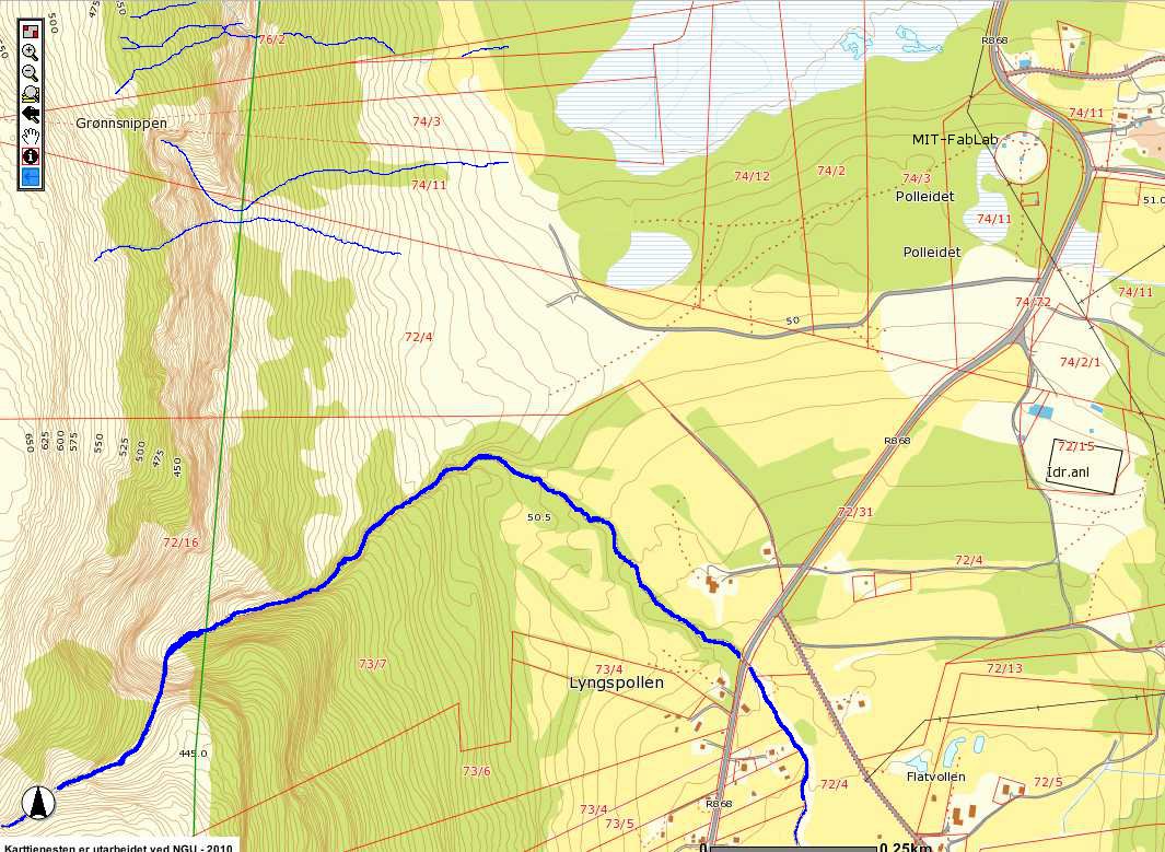
| 09:06, 14 September 2010 | Polleidet powerlines map.jpg (file) |  |
87 KB | Mapping of the local distribution power lines in the Polleidet area. | 1 |
| 09:18, 9 September 2010 | Peregrine falcon.jpg (file) |  |
752 KB | Peregrine falcon (Falco peregrinus) | 1 |
| 08:59, 9 September 2010 | Lyngen marsh.JPG (file) |  |
1.71 MB | Marshland located in the Polleidet area on the Lyngen peninsula. | 1 |
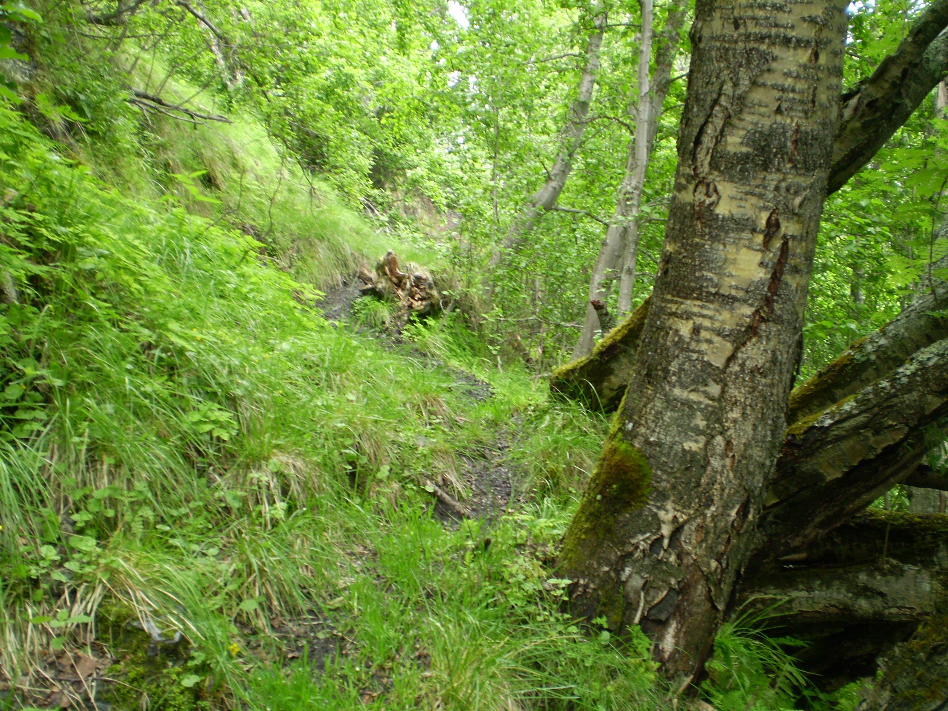
| 08:56, 9 September 2010 | Lyngen forest.JPG (file) |  |
1.73 MB | Typical forest cover found on approach to the Lyngen alps. | 1 |
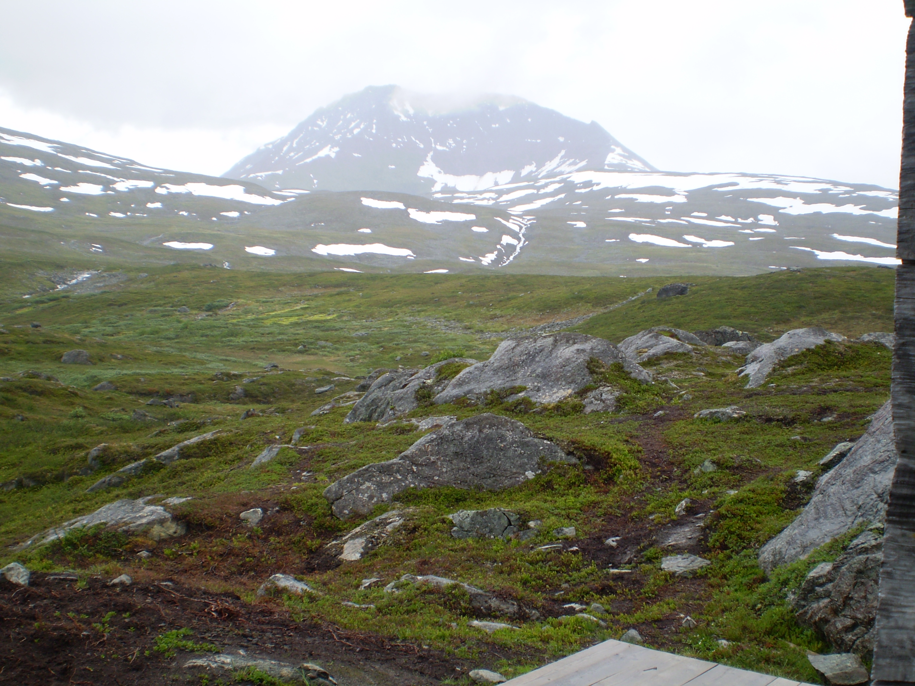
| 08:51, 9 September 2010 | Rundfjellet.JPG (file) |  |
1.74 MB | Alpine terrain looking west towards Rundfjellet on the Lyngen Peninsula, Norway. | 1 |
| 21:29, 7 September 2010 | Balsfjorden & Lyngsalpene summits.jpg (file) | 1.83 MB | A panorama view of the Lyngen Alps above the Balsfjorden as seen from Storsteinnes in 2009 February. Some summits and heights marked. | 1 | |
| 21:15, 7 September 2010 | Lyngen protected area map.jpg (file) |  |
188 KB | Hashed red area shows the portion of the Lyngen peninsula that is protected under norwegian environmental law. | 1 |
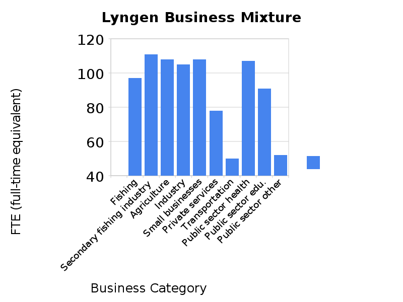
| 08:55, 2 September 2010 | Lyngen business mixture.png (file) |  |
32 KB | This table from 2004 does not account for the fishery crisis of 2005 which resulted in a large reduction of 50 FTE in the fish production category. This means the loss of even more jobs (approx. 80). Tourism is included in the "private services". | 1 |
| 07:43, 30 August 2010 | HyrdoFabLab1.jpg (file) |  |
176 KB | A map depicting the Hydrologic resources available around the MIT-FabLab in Lyngen, Norway | 1 |
| 15:14, 25 August 2010 | Bedrock lyngenmap.jpg (file) |  |
133 KB | The prominent bedrock for the Lyngen area and around the FabLab according to the Norwegian national institution for knowledge on bedrock, mineral resources, surficial deposits and groundwater (NGU). | 2 |
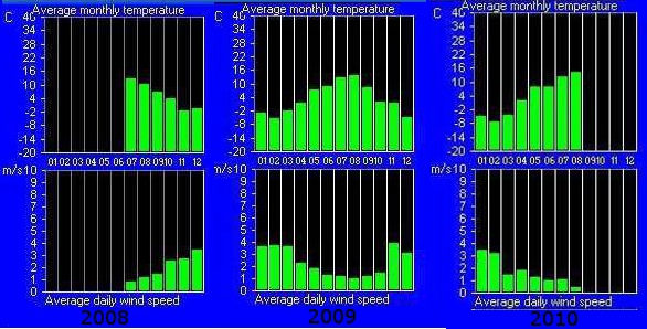
| 15:05, 18 August 2010 | FabLabWind data08-10.jpg (file) |  |
132 KB | Graphs showing the average monthly temperature and the average daily wind speed from mid 2008 up to mid 2010. Data is gathered from the weather station roughly 12m high on top of the FabLab. | 1 |
| 15:02, 18 August 2010 | FAbLabWind data08-10.jpg (file) |  |
132 KB | Graphs showing the average monthly temperature and the average daily wind speed from mid 2008 up to mid 2010. Data is gathered from the weather station roughly 12m high on top of the FabLab. | 1 |
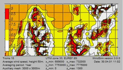
| 13:35, 18 August 2010 | Troms windmap50.jpg (file) |  |
33 KB | Wind model mapping at 50m of the northern tip of the Lyngen peninsula. | 1 |
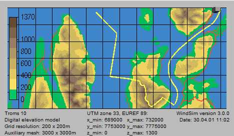
| 13:34, 18 August 2010 | Troms windmaptopo50.jpg (file) |  |
24 KB | Topographical mapping that corresponds to 50m wind mapping of the northern tip of the Lyngen peninsula. | 1 |
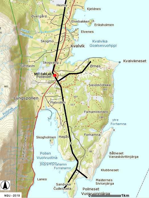
| 11:30, 18 August 2010 | FabLabtopo,39k.jpg (file) |  |
189 KB | Topographical representation of the area surrounding the lab including property boundaries at a scale of .39km. | 1 |
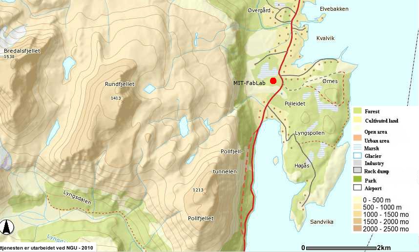
| 11:28, 18 August 2010 | FabLabtopo2k.jpg (file) |  |
68 KB | Topographical representation of the Lyngen,Polleidet area and its relation to the lab at a scale of 2km. | 1 |
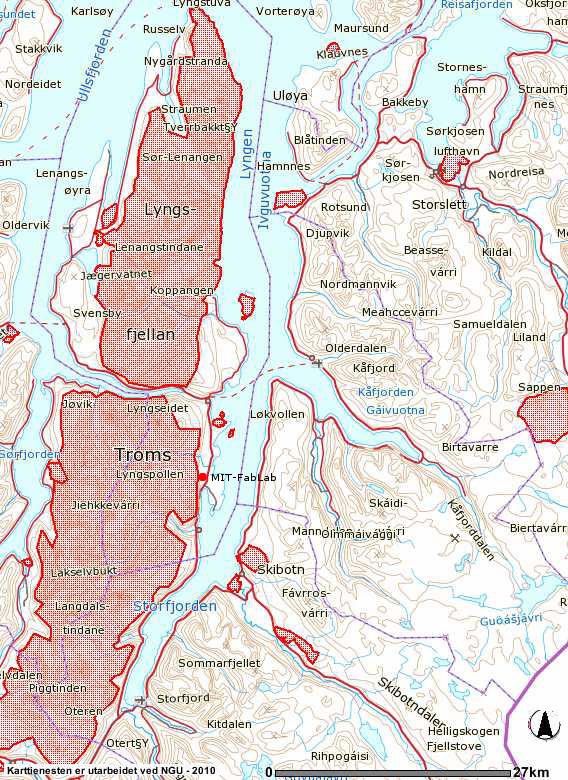
| 09:04, 18 August 2010 | Lyngentopo.jpg (file) |  |
465 KB | A topographical representation of Lyngen relative to the rest of Norway, as well as the position of the FabLab in relation to Lyngen. | 1 |
| 12:33, 17 August 2010 | Labfotodalrymple.jpg (file) |  |
156 KB | Picture of the MIT-FabLab in Lyngen Norway taken from the North. | 1 |